- Startseite
- Unterhaltungselektronik
- Automobil
- Navigation
- Navigator-Karten
- Garmin HXEU015R - Aegean Sea and Sea of Marmara – 010-C0773-20
Garmin HXEU015R - Aegean Sea and Sea of Marmara

Garmin HXEU015R - Aegean Sea and Sea of Marmara
MPN 010-C0773-20
EAN / UPC 753759091705
Lagerbestand
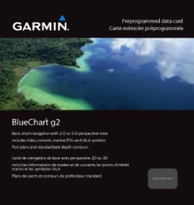
- Includes realistic navigation features showing everything from shaded depth contours and coastlines to spot soundings, navaids, port plans, wrecks, obstructions, intertidal zones, restricted areas, IALA symbols and more.
- Features smooth displays, including seamless transitions between zoom levels and more continuity across chart boundaries.
- Allows users to choose between standard 2-D direct overhead or 3-D "over the bow" map perspective to make chart reading and orientation easier.
Spezifikationen für 010-C0773-20
Features
Art
Road map
Geographische Abdeckung
Aegean Sea, Sea of Marmara
Package dimensions
Depth (package,cm)
13,018 cm
Gross Weight (Package, kg)
0,06 kg
Height (package,cm)
0,953 cm
Width (package,cm)
12,065 cm
Product dimensions
Depth (product,cm)
0,2 cm
Height (product,cm)
3,2 cm
Net Weight (Product, kg)
0,049999999999999996 kg
Product Width
2,4 cm
System requirements
Minimaler Prozessor
Intel, PowerPC G4
Minimum RAM
1024 MB
Vendor information
Brand Name
Warranty
2 Jahre)
Beschreibung
HXEU015R - Aegean Sea and Sea of Marmara
- Includes realistic navigation features showing everything from shaded depth contours and coastlines to spot soundings, navaids, port plans, wrecks, obstructions, intertidal zones, restricted areas, IALA symbols and more.
- Features smooth displays, including seamless transitions between zoom levels and more continuity across chart boundaries.
- Allows users to choose between standard 2-D direct overhead or 3-D "over the bow" map perspective to make chart reading and orientation easier.
- Provides Safety Shading (in compatible units), allowing mariners to enable contour shading for all depth contours shallower than user-defined safe depths.
- Provides Fishing Charts (in compatible units), allowing mariners to scope out bottom contours and depth soundings with less visual clutter on the display.
- Allows users to conveniently plan and organize routes, from your computer, before your trip with HomePort™, compatible trip-planning software (sold separately).
*Die oben genannten Produktdaten werden von Icecat zur Verfügung gestellt. EET ist nicht verantwortlich für eventuelle Fehler in diesem Zusammenhang.