- Hjem
- Consumer Electronics
- Automotive
- Navigation
- Navigator Maps
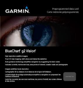
- Garmin 010-C0779-00 - Oslo to Trelleborg, microSD/SD – 010-C0779-00
Garmin 010-C0779-00 - Oslo to Trelleborg, microSD/SD
MPN 010-C0779-00
EAN/UPC 753759069599
Lager
Get a fresh perspective when you take to the water with BlueChart® g2 Vision®. With BlueChart g2 Vision data, you’ll get detailed marine cartography that provides convenient viewing of nautical content and other premium features. BlueChart g2 Vision allows you to see your vessel’s precise, on-chart position in relation to naviads, coastal features, anchorages, obstructions, waterways, restricted areas and more. You will also have access to detailed mapping capabilities that include Safety Shadin...
Læs den fulde beskrivelseSpecifikationer for 010-C0779-00
Features
Compatibility
GPSMAP 6012 GPSMAP 7012 GPSMAP 4008 GPSMAP 4010 GPSMAP 4012 GPSMAP 451/451s GPSMAP 5008 GPSMAP 5012 GPSMAP 5015 GPSMAP 551/551s GPSMAP 556/556s GPSMAP 6008 GPSMAP 620 GPSMAP 7015 GPSMAP 750/750s
Geographic coverage
Norwegian, Swedish
Type
Road map
Package dimensions
Depth (package,cm)
13,018 cm
Gross Weight (Package, kg)
0,2 kg
Height (package,cm)
0,953 cm
Width (package,cm)
12,065 cm
Product dimensions
Net Weight (Product, kg)
0,1 kg
Product Depth
0,2 cm
Product Height
3,2 cm
Product Width
2,4 cm
Vendor information
Brand Name
Warranty
2 År
Beskrivelse
010-C0779-00 - Oslo to Trelleborg, microSD/SD
Get a fresh perspective when you take to the water with BlueChart® g2 Vision®. With BlueChart g2 Vision data, you’ll get detailed marine cartography that provides convenient viewing of nautical content and other premium features. BlueChart g2 Vision allows you to see your vessel’s precise, on-chart position in relation to naviads, coastal features, anchorages, obstructions, waterways, restricted areas and more. You will also have access to detailed mapping capabilities that include Safety Shading, Fishing Charts, smooth data transition between zoom levels, harmonious transition across chart borders, and reduction of chart discontinuities. Premium features include 3-D perspective above and below the waterline, Auto Guidance, high-resolution imagery, and “real picture” aerial photos of ports, harbors, marinas, waterways, landmarks and other points of interest. It’s the most realistic mapping display Garmin has ever offered.
- Realistic navigation features showing everything from shaded depth contours and coastlines to spot soundings, navaids, port plans, wrecks, obstructions, intertidal zones, restricted areas, IALA symbols and more.
- Smooth display presentation including seamless transitioning between zoom levels and more continuity across chart boundaries.
- Safety shading allows user to enable contour shading for all depth contours shallower than user-defined safe depth.
- Fishing charts to help scope out bottom contours and depth soundings with less visual clutter on the display.
- High-resolution satellite imagery, when overlaid on the chart, provides the mariner with a realistic view of the land and water for unparalleled situational awareness.
- Aerial reference photography provides "real world" photos of ports, harbors, marinas, waterways, navigation landmarks and other points of interest, offering the mariner another powerful tool for navigating unfamiliar waters.
- MarinerEye view 3-D perspective provides a bird's eye view from behind the boat showing the chart information for a quick, reliable and easy position fix.
- FishEye view 3-D perspective provides an underwater view that visually represents the sea floor according to the chart's information.
- Auto Guidance technology searches chart data to suggest the best passage to a destination. Includes tides, currents, marine services, coastal roads and points of interest.
- Compatible with HomePort™ — software that lets you use BlueChart data to conveniently plan and organize routes from your computer before your trip.
*Produktdata ovenfor leveres af Icecat. EET kan ikke holdes ansvarlig for fejl i forbindelse hertil.

