- Hlavní stránka
- Spotřební elektronika
- Automotive
- Navigace
- Navigační mapy
- Garmin 010-C1049-00 – 010-C1049-00
Garmin 010-C1049-00


Garmin 010-C1049-00
MPN 010-C1049-00
EAN / UPC 753759968519
Úroveň zásob
TOPO Australia & New Zealand
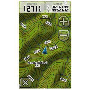
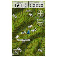
Get enhanced topographic detail on your compatible device whether you're in the outback or on a main boulevard in the city. This mapping product provides a wide array of topographic information from terrain contours, elevations and summits to coverage of perennial and intermittent lakes, rivers and streams in Australia and New Zealand.
- Provides topographic terrain contours at 20 m (65 ft) intervals, approximating 1:100K maps, and summit points ...
Specifikace pro 010-C1049-00
Features
Geographic coverage
Australia, New Zealand
Type
Road map
Package dimensions
Gross Weight (Package, kg)
0,36 kg
Product dimensions
Net Weight (Product, kg)
0,33 kg
System requirements
Minimum RAM
1024 MB
Vendor information
Brand Name
Warranty
2 Rok (y)
Popis
010-C1049-00
TOPO Australia & New Zealand
Get enhanced topographic detail on your compatible device whether you're in the outback or on a main boulevard in the city. This mapping product provides a wide array of topographic information from terrain contours, elevations and summits to coverage of perennial and intermittent lakes, rivers and streams in Australia and New Zealand.
- Provides topographic terrain contours at 20 m (65 ft) intervals, approximating 1:100K maps, and summit points for detailed lay of the land;
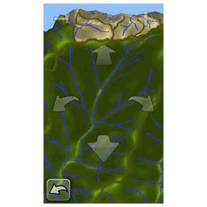
- Contains tracks, outback trails, 4WD destinations and hydrographic features, including lake/river shorelines and perennial and seasonal streams;
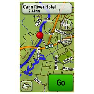
- Includes famous outback routes, such as Birdsville, Strezelecki, Oodnadatta, Canning Stock and more;
- Features searchable points of interests in urban, rural and outback areas, including lodging, restaurants, camping locations, homesteads, caravan parks, shopping and more;
- Includes routable road content, by NAVTEQ, to give you turn-by-turn directions to your destination. Additional content provided by HEMA and LINZ;
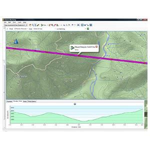
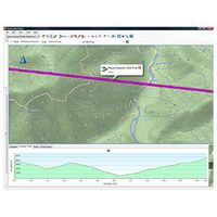
- Provides elevation profile on compatible devices so you can estimate terrain difficulty;
- Displays national, state and local parks, forests and reserve areas;
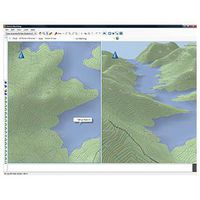
- (DVD only) Includes BaseCamp™ software for managing data on your GPS and computer, playing back routes and tracks, geotagging photos and more.
*Výše uvedené údaje o produktu poskytuje společnost Icecat. EET nenese odpovědnost za chyby v této souvislosti.