- Início
- Eletrónica de Consumo
- Automotive
- Navegação
- Mapas de Navegação
- Garmin VEU019R-Alborg to Amsterdam – 010-C0776-00
Garmin VEU019R-Alborg to Amsterdam

Garmin VEU019R-Alborg to Amsterdam
MPN 010-C0776-00
EAN/UPC 753759069568
Nível de stock
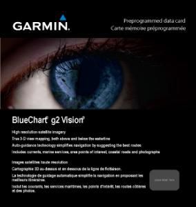
- Includes realistic navigation features showing everything from shaded depth contours and coastlines to spot soundings, navaids, port plans, wrecks, obstructions, intertidal zones, restricted areas, IALA symbols and more.
- Features smooth displays, including seamless transitions between zoom levels and more continuity across chart boundaries.
- Includes high-resolution satellite imagery, when overlaid on the chart, provides the mariner with a realistic view of the land and water for unpa...
Especificações para 010-C0776-00
Features
Geographic coverage
Alborg - Amsterdam
Type
Road map
Package dimensions
Depth (package,cm)
13,018 cm
Gross Weight (Package, kg)
0,2 kg
Height (package,cm)
0,953 cm
Width (package,cm)
12,065 cm
Product dimensions
Net Weight (Product, kg)
0,1 kg
Product Depth
0,2 cm
Product Height
3,2 cm
Product Width
2,4 cm
System requirements
Minimum processor
Intel, PowerPC G4
Minimum RAM
1024 MB
Vendor information
Brand Name
Warranty
2 Ano(s)
Descrição
VEU019R-Alborg to Amsterdam
- Includes realistic navigation features showing everything from shaded depth contours and coastlines to spot soundings, navaids, port plans, wrecks, obstructions, intertidal zones, restricted areas, IALA symbols and more.
- Features smooth displays, including seamless transitions between zoom levels and more continuity across chart boundaries.
- Includes high-resolution satellite imagery, when overlaid on the chart, provides the mariner with a realistic view of the land and water for unparalleled situational awareness.
- Features aerial “real world” photos of ports, harbors, marinas, waterways, navigational landmarks and other points of interest, offering the mariner another powerful tool for navigating unfamiliar waters.
- Includes Auto Guidance technology that searches chart data - tides, currents, marine services, coastal roads and points of interest - to suggest the best passage to a destination.
- Offers MarinerEye view 3-D perspective, providing a bird's eye view from behind the boat showing the chart information for a quick, reliable and easy position fix.
- Offers FishEye view 3-D perspective, providing an underwater view that visually represents the sea floor according to the chart's information.
- Provides Safety Shading (in compatible units), allowing mariners to enable contour shading for all depth contours shallower than user-defined safe depths.
- Provides Fishing Charts (in compatible units), allowing mariners to scope out bottom contours and depth soundings with less visual clutter on the display.
- Allows users to conveniently plan and organize routes, from your computer, before your trip with HomePort™, compatible trip-planning software (sold separately).
*Os dados do produto acima são fornecidos pela Icecat. A EET não pode ser responsabilizada por erros relacionados.