- Accueil
- Electronique grand public
- Accessoires automobile
- Navigation
- Cartes GPS
- Garmin TOPO Canada – 010-C1086-00
Garmin TOPO Canada

Garmin TOPO Canada
MPN 010-C1086-00
EAN / UPC 753759991081
Niveau de stock
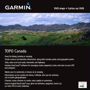
We've mapped every hill and valley for your next great adventure. This map covers the finer details of the outdoors, including terrain contours, topo elevations, summits, routable roads and trails, rivers, lakes and geographical points.
- Provides detailed topographic maps, based on digital 1:250,000 and 1:50,000 scale NTS data.
- Contains hydrographic features, including coastlines, lake/river shorelines, wetlands and perennial and seasonal streams.
- Includes searchable points of ...
Caractéristiques 010-C1086-00
Caractéristiques
Compatibilité de marque
Garmin
Couverture nationale
Canada
Emplacement de la région
Amérique du nord
Type
Road map
Type de distribution
MicroSD/SD
Type de navigation
Voiture
Package dimensions
Gross Weight (Package, kg)
5 kg
Product dimensions
Height (product,cm)
0,64 cm
Net Weight (Product, kg)
4,9 kg
Product Depth
12,07 cm
Product Width
12,7 cm
Vendor information
Brand Name
Warranty
2 Année (s)
Description
TOPO Canada
We've mapped every hill and valley for your next great adventure. This map covers the finer details of the outdoors, including terrain contours, topo elevations, summits, routable roads and trails, rivers, lakes and geographical points.
- Provides detailed topographic maps, based on digital 1:250,000 and 1:50,000 scale NTS data.
- Contains hydrographic features, including coastlines, lake/river shorelines, wetlands and perennial and seasonal streams.
- Includes searchable points of interest, such as parks, campgrounds, scenic lookouts and picnic sites.
- Offers terrain contour and elevation information, along with summits, peaks and geographic points.
- Contains routable roads, trails and highways in metropolitan and rural areas so getting to your destination is easy.
- Displays national, state, local parks, forests and wilderness areas.
- Includes BaseCamp™ software (DVD Only) for managing data on your GPS and computer, playing back routes and tracks, geotagging photos and more.
*Les données produit ci-dessus sont fournies par Icecat. A cet égard, EET ne peut être tenu responsable des erreurs.