- Inicio
- Electrónica de Consumo
- Automotor
- Navegación
- Mapas para navegador
- Garmin VEU012R - Mediterranean Sea, Central-West – 010-C0770-00
Garmin VEU012R - Mediterranean Sea, Central-West

Garmin VEU012R - Mediterranean Sea, Central-West
MPN 010-C0770-00
EAN / UPC 753759069506
Nivel de existencias
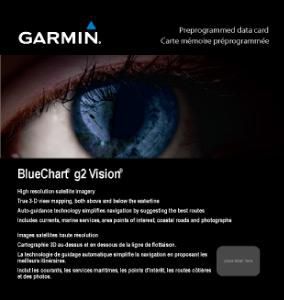
See your vessel’s precise, on-chart position in relation to navaids, coastal features and restricted areas with premium features found in this detailed marine mapping data. Includes all of the features of our BlueChart® g2 product, plus 3-D perspective above and below the waterline, Auto Guidance, high-resolution imagery, and aerial photos of ports, harbors, marinas and landmarks.
- Shaded depth contours, coastlines, spot soundings, navaids, port plans, wrecks, obstructions, intertidal zo...
Especificaciones de 010-C0770-00
Features
Cobertura geográfica
Mediterranean Sea, Central-West
Compatibilidad
echoMAP 50dv echoMAP 50s echoMAP 70dv echoMAP 70s GPSMAP 1020xs GPSMAP 1040xs GPSMAP 4008 GPSMAP 4010 GPSMAP 4012 GPSMAP 420/420s GPSMAP 4208 GPSMAP 421 GPSMAP 4210 GPSMAP 4212 GPSMAP 421s GPSMAP 430/430s
Tipo
Road map
Package dimensions
Gross Weight (Package, kg)
0,12 kg
Product dimensions
Net Weight (Product, kg)
0,11 kg
Product Depth
2,39 cm
Product Height
18,72 cm
Product Width
14,4 cm
System requirements
Espacio de almacenamiento recomendado en la unidad
1 GB
Procesador mínimo
Intel, PowerPC G4
RAM recomendada
1024 MB
Vendor information
Brand Name
Warranty
2 Año/s
Descripción
VEU012R - Mediterranean Sea, Central-West
See your vessel’s precise, on-chart position in relation to navaids, coastal features and restricted areas with premium features found in this detailed marine mapping data. Includes all of the features of our BlueChart® g2 product, plus 3-D perspective above and below the waterline, Auto Guidance, high-resolution imagery, and aerial photos of ports, harbors, marinas and landmarks.
- Shaded depth contours, coastlines, spot soundings, navaids, port plans, wrecks, obstructions, intertidal zones, restricted areas and IALA symbols.
- Seamless transitions between zoom levels and more continuity across chart boundaries.
- High resolution satellite imagery for a realistic view of the land and water.
- Aerial photos of ports, harbors, marinas, waterways, navigational landmarks and other POIs.
- Auto Guidance technology searches chart data to suggest the best passage to a destination.
- MarinerEye view 3-D perspective for a quick, easy position fix.
- FishEye view 3-D perspective for an underwater view of the sea floor.
- Safety Shading* enables contour shading for all depth contours shallower than your defined safe depths.
- Fishing Charts* to scope out bottom contours and depth soundings with less visual clutter on the display.
- Plan and organize routes from your computer with HomePort™.
*Los datos de producto anteriores son proporcionados por Icecat. EET no se hace responsable de los errores en relación con esto.