- Startseite
- Unterhaltungselektronik
- Automobil
- Navigation
- GPS-Tracker
- Garmin Oregon 700 - 240x400pix TFT, 209.8g, 2xAA, 1.7GB, IPX7, microSD – 010-01672-01
Garmin Oregon 700 - 240x400pix TFT, 209.8g, 2xAA, 1.7GB, IPX7, microSD


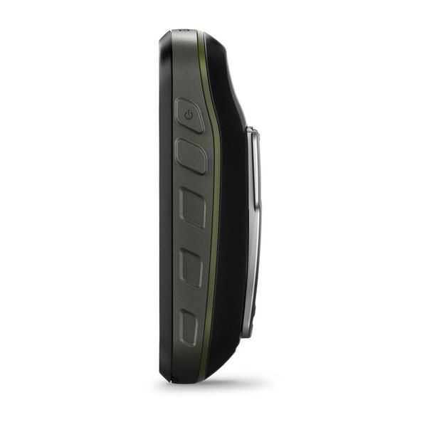
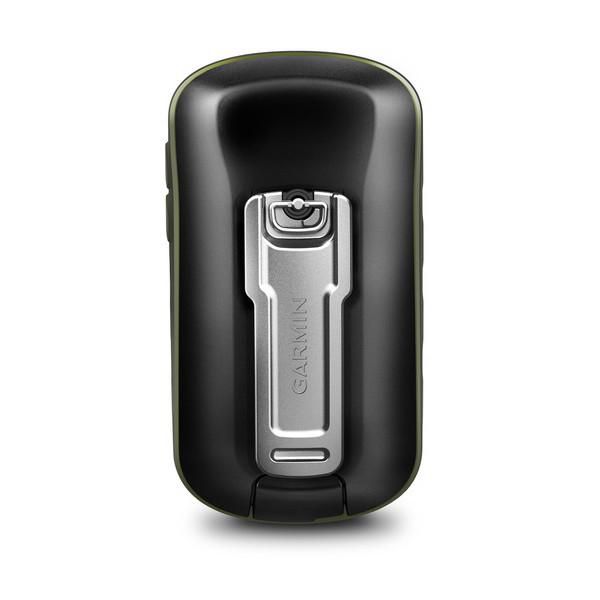


Garmin Oregon 700 - 240x400pix TFT, 209.8g, 2xAA, 1.7GB, IPX7, microSD
MPN 010-01672-01
EAN / UPC 753759163402
Lagerbestand
- High-sensitivity dual GPS and GLONASS satellite reception for better performance in challenging environments than GPS alone
- Redesigned antenna enables better reception and performance; 3-axis compass with accelerometer and barometric altimeter sensors
- 3-inch sunlight-readable touchscreen with dual orientation (landscape or portrait view)
- Expanded wireless connectivity (Wi-Fi, Bluetooth®, ANT+® capable); supports Active Weather and Geocaching Live
- Bluetooth®-enabled smar...
Spezifikationen für 010-01672-01
Battery
Akkulaufzeit (max.)
16 Hour
Anzahl der unterstützten Batterien
2
Batterietyp
Rechargeable
Wiederaufladbare Batterie
Yes
Display
Anzeigegröße (HxV)
63 x 38 mm
Berührungssensitiver Bildschirm
Yes
Bildschirmauflösung
240 x 400 Pixels
Diagonale anzeigen
3 "
Display-Technologie
TFT
Eingebautes Display
Yes
Features
Ability to add maps
Yes
Barometrischer Höhenmesser
Yes
Basemap
Yes
Eingebaute Kamera
No
Elektronischer Kompass
Yes
Flächenberechnung
Yes
Informationen zu Sonne und Mond
Yes
Internationaler Schutzcode (IP)
IPX7
Jagd-/Fischkalender
Yes
Picture viewer
Yes
Produktfarbe
Black, Grey
Schutzfunktionen
Water resistant
Tide tables
Yes
Übertragung von Einheit zu Einheit
Yes
Zweck
Personal
Memory
Anzahl der Tracklog-Punkte
20000
Anzahl der Wegpunkte
10000
Eingebaute Speicherkapazität
1,7 GB
Eingebauter Speicher
Yes
Kompatible Speicherkarten
MicroSD (TransFlash)
Routenmenge
250
Speicherkartensteckplätze
Yes
Wegpunkte
Yes
Package dimensions
Gross Weight (Package, kg)
0,5 kg
Packaging content
Batterien enthalten
No
Kabel enthalten
USB
Speicherkarte enthalten
No
Ports & interfaces
USB-Anschluss
Yes
USB-Version
2.0
Product dimensions
Height (product,cm)
11,4 cm
Net Weight (Product, kg)
0,4 kg
Product Width
6,1 cm
Tiefe cm
3,3 cm
Technical details
Barometrischer Höhenmesser
Yes
Basiskarte
Yes
Bildbetrachter
Yes
Eingebaute Kamera
No
Elektronischer Kompass
Yes
Fähigkeit, Karten hinzuzufügen
Yes
Flächenberechnung
Yes
Gezeitentabellen
Yes
Informationen zu Sonne und Mond
Yes
Internationaler Schutzcode (IP).
IPX7
Jagd-/Fischkalender
Yes
Produktfarbe
Black, Grey
Schutzfunktionen
Water resistant
Übertragung von Einheit zu Einheit
Yes
Zweck
Personal
Vendor information
Brand Name
Warranty
2 Jahre)
Beschreibung
Oregon 700 - 240x400pix TFT, 209.8g, 2xAA, 1.7GB, IPX7, microSD
- High-sensitivity dual GPS and GLONASS satellite reception for better performance in challenging environments than GPS alone
- Redesigned antenna enables better reception and performance; 3-axis compass with accelerometer and barometric altimeter sensors
- 3-inch sunlight-readable touchscreen with dual orientation (landscape or portrait view)
- Expanded wireless connectivity (Wi-Fi, Bluetooth®, ANT+® capable); supports Active Weather and Geocaching Live
- Bluetooth®-enabled smart notifications¹ and automatic uploads to Garmin Connect™ online community
At a Glance
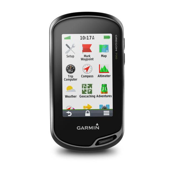
Thanks to a redesigned antenna for better satellite reception, the Oregon 700 GPS and GLONASS handheld puts even more of the great outdoors at your fingertips. Whether you’re hiking, hunting, climbing, kayaking, trail riding or whatever, this rugged navigator is ready for anything. It features multilink wireless connectivity (Wi-Fi, Bluetooth and ANT+), Active Weather support with animated radar overlays, a 1-year BirdsEye Satellite Imagery subscription and a built-in 3-axis compass with barometric altimeter.
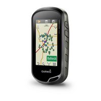
Find Fun with Geocaching.com
The wireless Wi-Fi link and Bluetooth links on your Oregon 700 makes it easier than ever to enjoy a superior geocaching experience. You can set your device to automatically stay up to date with all the latest caches from Geocaching.com. No more manual entry of coordinates or printing out cache details on paper.
More Connectivity, Less Complexity
The expanded wireless capabilities of Oregon 700 make it easier than ever to download software, receive smart notifications¹ and upload adventures to our Garmin Connect online community. You can even share LiveTrack location data or geocache discoveries, unit-to-unit, with other compatible Garmin handheld devices. Smart notifications via Bluetooth connectivity with a compatible smartphone let you receive emails, texts and alerts right on your device. So you can see what’s going on while you’re getting away from it all.
Navigate Your Way
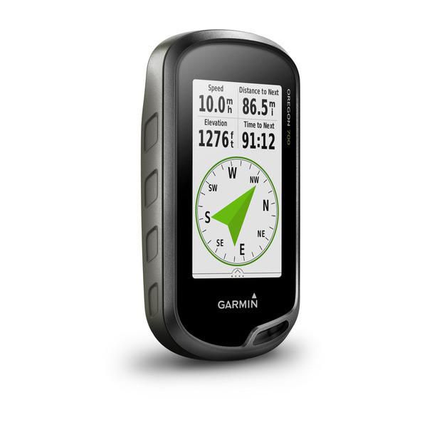
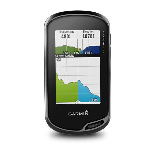
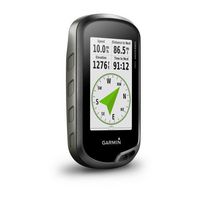
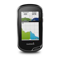
The Oregon 700 handheld provides comprehensive navigation and tracking to guide you on and off the beaten path, using GPS and GLONASS plus ABC (altimeter, barometer and compass) sensor capabilities. The built-in altimeter provides elevation data to accurately monitor ascent and descent, while the barometer can be used to predict weather changes by showing short-term trends in air pressure. The 3-axis electronic compass keeps your bearing, whether you’re moving or not. There’s also a TracBack® feature on Oregon 700 to help you navigate back to your starting point the same way you came. You can also mark locations, such as your campsite, vehicle or other points of interest, to which you'd like return navigation.
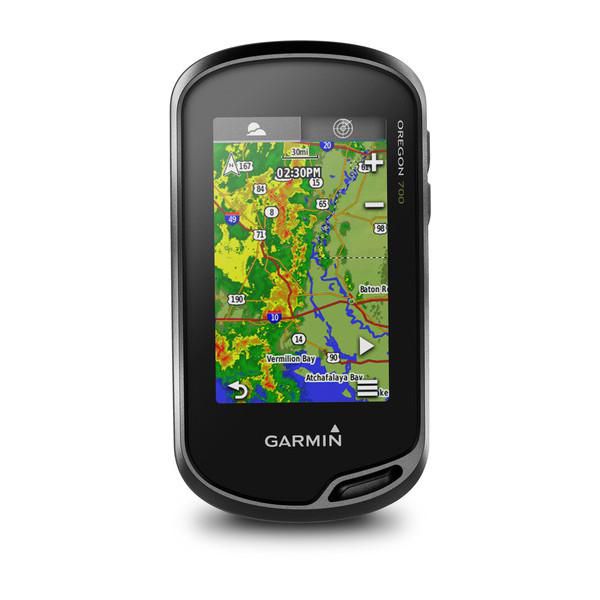
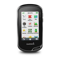
Enjoy the View on a Vivid Display
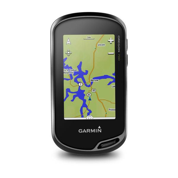
The Oregon 700 handheld features a bright, sunlight-readable 3-inch color touchscreen display with dual orientation for landscape or portrait views. It easily supports multiple mapping options such as BlueChart® g2 HD for water navigation or City Navigator® NT for turn-by-turn driving directions. Durable and water-rated to IPX7, the Oregon series is built to keep delivering vital mapping and tracking data, no matter what the elements throw at you. Plus, you can even customize your Oregon’s display with free downloads of apps, widgets and data fields from the Garmin Connect IQ™ online store².
Plan Your Next Trip
Take charge of your next adventure with BaseCamp™, software that lets you view and organize maps, waypoints, routes and tracks. This free trip-planning software even allows you to create Garmin Adventures that you can share with friends, family or fellow explorers online. BaseCamp displays on your computer screen any topographic map data stored on the device, including contour lines and elevation profiles. It also can transfer an unlimited amount of satellite images to your device when paired with a BirdsEye Satellite Imagery subscription.
Dokumente
*Die oben genannten Produktdaten werden von Icecat zur Verfügung gestellt. EET ist nicht verantwortlich für eventuelle Fehler in diesem Zusammenhang.