- Startseite
- Unterhaltungselektronik
- Automobil
- Navigation
- Navigatoren
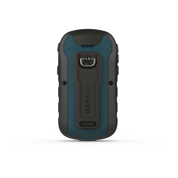
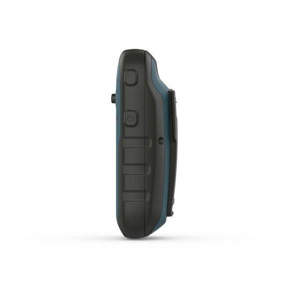
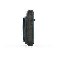
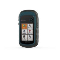
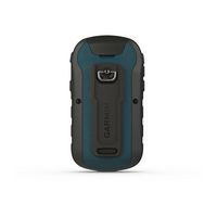
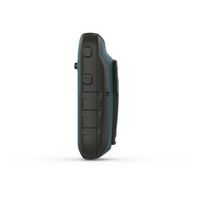
- Garmin eTrex 22x, 2.2" TFT 240x320, USB, 8 GB, IPX7, 2x AA, microSD, 54x103x33 mm – 010-02256-01
Garmin eTrex 22x, 2.2" TFT 240x320, USB, 8 GB, IPX7, 2x AA, microSD, 54x103x33 mm


 Play
Play Play
Play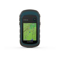

 Play
Play Play
PlayGarmin eTrex 22x, 2.2" TFT 240x320, USB, 8 GB, IPX7, 2x AA, microSD, 54x103x33 mm
MPN 010-02256-01
EAN / UPC 753759230777
Lagerbestand
eTrex 22x and eTrex 32x offer the same ease-of-use, durability and affordability that the eTrex handheld GPS series is known for — along with preloaded TopoActive maps. These devices are perfect for ATVs, bicycles, boats or hiking.
See the Way
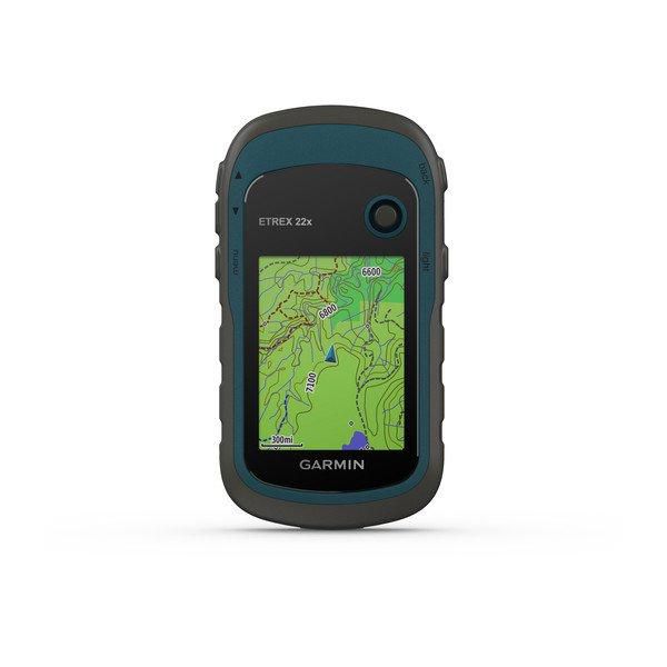
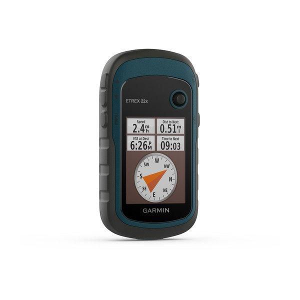
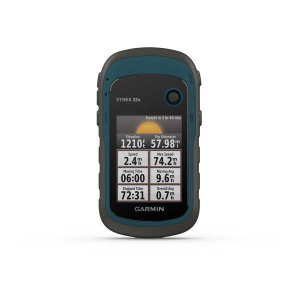
eTrex 22x and 32x offer enhanced 2.2”, 65K color, sunlight-readable displays. Durable and water resistant, these handhelds are built to withstand the elements.
Explore the Terrain
The eTrex 22x and 32x handheld devices com...
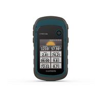
2.2” sunlight-readable color display with 240 x 320 display pixels for improved readability
Preloaded with TopoActive maps with routable roads and trails for cycling and hiking
Support for GPS and GLONASS satellite systems allows for tracking in more challenging environments than GPS alone
8 GB of internal memory for map downloads plus a microSD™ card slot
eTrex 32x adds a 3-axis compass and barometric altimeter
Battery life: up to 25 hours in GPS mode with 2 AA batteries
Spezifikationen für 010-02256-01
Battery
Akkulaufzeit (max.)
25 Hour
Anzahl der unterstützten Batterien
2
Batterietyp
Replaceable
Replaceable battery
Y/Yes
Design
Einfach zu verwenden
Y/Yes
Formfaktor
Handheld
Internationaler Schutzcode (IP).
IPX7
Produktfarbe
Black/Grey
Display
Anzahl der Farben anzeigen
65536 colours
Anzeige
TFT
Anzeigegröße (HxV)
35 x 44 mm
Berührungssensitiver Bildschirm
N/No
Bildschirmauflösung
240 x 320 Pixels
Breitbild
N/No
Diagonale anzeigen
2.2 "
Display mit Hintergrundbeleuchtung
Y/Yes
Display-Technologie
TFT
Eingebautes Display
Y/Yes
Features
Ability to add maps
Y/Yes
Basemap
Y/Yes
Elektronischer Kompass
N/No
Flächenberechnung
Y/Yes
Informationen zu Sonne und Mond
Y/Yes
Internationaler Schutzcode (IP)
IPX7
Jagd-/Fischkalender
Y/Yes
Picture viewer
Y/Yes
Pre-installed maps
TopoActive Europe
Produktfarbe
Black/Grey
Schutzfunktionen
Water resistant
Zweck
Personal
GPS Performance
Antenne
Internal
GPS type
Auto
N/No
Fahrrad
Y/Yes
Geocaching (GPS-Verstecksuche)
Y/Yes
Golf
N/No
LKW
N/No
Luftfahrt
N/No
Marine (Kartenplotter, Echolote)
N/No
Motorrad
N/No
Outdoor (Wandern, Trekking)
Y/Yes
Sport (Fitness, Laufen)
Y/Yes
Wohnmobil/Wohnwagen
N/No
Map
Fähigkeit, Karten hinzuzufügen
Y/Yes
Memory
Anzahl der Tracklog-Punkte
200
Anzahl der Wegpunkte
2000
Eingebaute Speicherkapazität
8 GB
Eingebauter Speicher
Y/Yes
Interne Speicherkapazität
8 GB
Kompatible Speicherkarten
MicroSD (TransFlash)
RAM-Kapazität
8000 MB
Routenmenge
200
Speicherkartensteckplätze
Y/Yes
Verfolgt Menge
10000
Wegpunkte
Y/Yes
Navigation
Anzahl der Wegpunkte
2000
Barometrischer Höhenmesser
Y/Yes
Flächenberechnung
Y/Yes
Live-Dienst
Y/Yes
Routenmenge
200
Routenvermeidung
Y/Yes
Sehenswürdigkeiten
Y/Yes
Traffic Message Channel (TMC)
N/No
Verfolgt Menge
10000
Wegpunkte
Y/Yes
Network
Bluetooth
N/No
Other features
Basiskarte
Y/Yes
Number of tracklog points
200
Package dimensions
Gross Weight
0.141 kg
Packaging content
Kabel enthalten
USB
Schnellstartanleitung
Y/Yes
Performance
Eingebaute Kamera
N/No
Informationen zu Sonne und Mond
Y/Yes
Jagd-/Fischkalender
Y/Yes
Text-zu-Sprache-Nachrichtenleser
N/No
Ports & interfaces
Anzahl der Mini-USB 2.0-Anschlüsse
1
USB-Anschluss
Y/Yes
USB-Anschlusstyp
Mini-USB
USB-Konnektivität
Y/Yes
Power
Akkulaufzeit (max.)
25 Hour
Anzahl der unterstützten Batterien
2
Batterietyp
AA
Stromquellentyp
Battery
Product dimensions
Height (product,cm)
3.3 cm
Net Weight
0.14 kg
Tiefe cm
10.3 cm
Width (product,cm)
5.4 cm
Technical details
Basiskarte
Y/Yes
Bildbetrachter
Y/Yes
Elektronischer Kompass
N/No
Fähigkeit, Karten hinzuzufügen
Y/Yes
Flächenberechnung
Y/Yes
Informationen zu Sonne und Mond
Y/Yes
Internationaler Schutzcode (IP).
IPX7
Jagd-/Fischkalender
Y/Yes
Produktfarbe
Black/Grey
Schutzfunktionen
Water resistant
Vorinstallierte Karten
TopoActive Europe
Zweck
Personal
Vendor information
Brand Name
Warranty
2 Jahre)
Beschreibung
eTrex 22x, 2.2" TFT 240x320, USB, 8 GB, IPX7, 2x AA, microSD, 54x103x33 mm
eTrex 22x and eTrex 32x offer the same ease-of-use, durability and affordability that the eTrex handheld GPS series is known for — along with preloaded TopoActive maps. These devices are perfect for ATVs, bicycles, boats or hiking.
See the Way
eTrex 22x and 32x offer enhanced 2.2”, 65K color, sunlight-readable displays. Durable and water resistant, these handhelds are built to withstand the elements.
Explore the Terrain
The eTrex 22x and 32x handheld devices come preloaded with road-routable TopoActive maps that feature streets and trails so you can take the journey off the grid. Now you can know your surroundings — such as waterways, natural features as well as buildings, international boundaries and more. You can also find thousands of points of interests, including shops, restaurants, universities, car parks and accommodations.
Keep Your Fix
The eTrex series uses both GPS and GLONASS satellite systems so the receiver has the ability to track in more challenging environments than GPS alone. eTrex 32x adds a 3-axis compass and barometric altimeter, making it easy for you to keep your bearings.
Add Maps
With a microSD card slot and expanded 8 GB of internal memory, you can easily download additional maps for wherever the adventure takes you.
Satellite Imagery
Both devices support BirdsEye Satellite Imagery (subscription required), so you can download and integrate satellite imagery with your maps.
Find Fun
eTrex 22x and eTrex 32x support paperless geocaching. Upload GPX files straight to your device, and view key information such as location, terrain and hints from Geocaching.com
Go Anywhere
With an array of compatible mounts, eTrex is designed as a handheld — for use on ATVs or bicycles, in boats or on foot. Use the auto mount capability and City Navigator® NT maps for turn-by-turn driving directions, or use the rugged mount for your motorcycle or ATV. Wherever you think you might take eTrex, it has the mapping and mounts to get you there.
Dokumente
*Die oben genannten Produktdaten werden von Icecat zur Verfügung gestellt. EET ist nicht verantwortlich für eventuelle Fehler in diesem Zusammenhang.