- Hjem
- Consumer Electronics
- Automotive
- Navigation
- Navigator Maps
- Garmin France Inland Waters, SD card – 010-C1104-00
Garmin France Inland Waters, SD card

Garmin France Inland Waters, SD card
MPN 010-C1104-00
EAN/UPC 753759107659
Lager
Premier coastal charts
Experience unparalleled coverage and brilliant detail when you’re on the water. BlueChart g3 Vision coastal charts provide industry-leading coverage, clarity and detail with integrated Garmin and Navionics content.
Auto Guidance
Whether you are fishing or cruising, select a spot, and get a route showing you the general path and nearby obstructions at a safe depth.
Depth Range Shading
This feature displays high-resolution Dep...
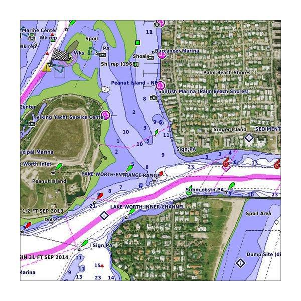
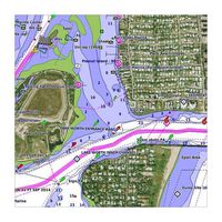
Industry-leading coverage, clarity and detail with updated coastal charts that feature integrated Garmin and Navionics® content
Auto Guidance technology quickly calculates a suggested route by using your desired depth and overhead clearance
Includes Depth Range Shading for up to 10 depth ranges, enabling you to view your target depth at a glance
Up to 1-foot contours provide a more accurate depiction of the bottom structure for improved fishing charts
To give a clear picture of shallow waters to avoid, the Shallow Water Shading allows for shading at a user-defined depth
Specifikationer for 010-C1104-00
Features
3D above & below waterline
Yes
Auto Guidance technology
Yes
Brand compatibility
Garmin
Coverage details
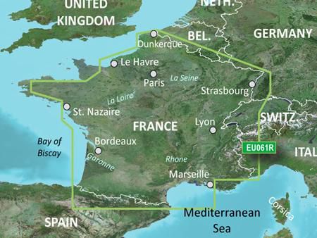
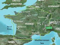
France Inland Waters
Distribution type
MicroSD/SD
Map type
Freshwater map
Region location
Europe
Satellite imageries
Yes
Shaded depth contours
Yes
Type
Water map
Package dimensions
Gross Weight (Package, kg)
0,1 kg
Product dimensions
Net Weight (Product, kg)
0,09 kg
Vendor information
Brand Name
Warranty
2 År
Beskrivelse
France Inland Waters, SD card
Premier coastal charts
Experience unparalleled coverage and brilliant detail when you’re on the water. BlueChart g3 Vision coastal charts provide industry-leading coverage, clarity and detail with integrated Garmin and Navionics content.
Auto Guidance
Whether you are fishing or cruising, select a spot, and get a route showing you the general path and nearby obstructions at a safe depth.
Depth Range Shading
This feature displays high-resolution Depth Range Shading for up to 10 depth ranges, so you can view your designated target depth.
Shallow Water Shading
To give a clear picture of shallow waters to avoid, this feature allows for shading at a user-defined depth.
Detailed contours
BlueChart g3 Vision charts feature 1-foot contours that provide a more accurate depiction of bottom structure for improved fishing charts and enhanced detail in swamps, canals and port plans.
Satellite imagery
Satellite imagery with navigational charts overlaid gives you a realistic view of your surroundings. It’s our most realistic charting display in a chartplotter — ideal for entering unfamiliar harbours or ports.
FishEye view
This underwater perspective shows 3-D representation of bottom and contours as seen from below the waterline. Interface with sonar data for a customised view.
MarinerEye view
This view provides a 3-D representation of the surrounding area both above and below the waterline.
Aerial photography
Crystal-clear aerial photography shows exceptional detail of many ports, harbours and marinas and is ideal when entering unfamiliar ports.
*Produktdata ovenfor leveres af Icecat. EET kan ikke holdes ansvarlig for fejl i forbindelse hertil.