- Hjem
- Consumer Electronics
- Automotive
- Navigation
- Navigator Maps
- Garmin Denmark East and Sweden South – 010-C0777-20
Garmin Denmark East and Sweden South


Garmin Denmark East and Sweden South
MPN 010-C0777-20
EAN/UPC 753759091781
Lager
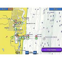
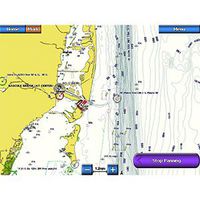
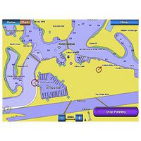
Improve Your View
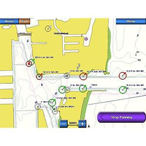
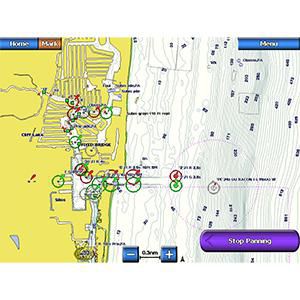
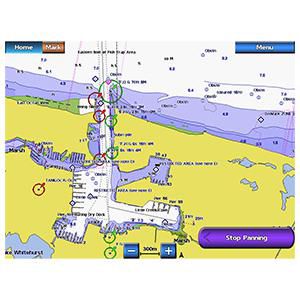
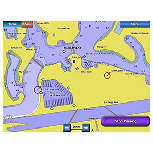
BlueChart g2 marine maps feature crisp labeling and an overall smoother presentation on your chartplotter display.
In addition to the basic charts, tidal stations, currents, depth contours, IALA symbols and included fishing charts, BlueChart g2 offers improved transitioning between zoom levels and more seamless continuity across chart boundaries.
Customize Your Screens
BlueChart g2 also adds Safety Shading which allows the user to enabl...
Specifikationer for 010-C0777-20
Features
Geographic coverage
DK, SE
Type
Road map
Package dimensions
Depth (package,cm)
13,018 cm
Gross Weight (Package, kg)
0,02 kg
Height (package,cm)
0,953 cm
Width (package,cm)
12,065 cm
Product dimensions
Net Weight (Product, kg)
0,01 kg
Vendor information
Brand Name
Warranty
2 År
Beskrivelse
Denmark East and Sweden South
Improve Your View
BlueChart g2 marine maps feature crisp labeling and an overall smoother presentation on your chartplotter display.
In addition to the basic charts, tidal stations, currents, depth contours, IALA symbols and included fishing charts, BlueChart g2 offers improved transitioning between zoom levels and more seamless continuity across chart boundaries.
Customize Your Screens
BlueChart g2 also adds Safety Shading which allows the user to enable contour shading for all depth contours shallower than the user-defined safe depth.
The fishing charts are designed to emphasize bathymetric contours with less visual clutter on the display.
There’s also a choice of standard 2-D direct overhead or 3-D “over-the-bow” map views for easier chart reading and orientation.
*Produktdata ovenfor leveres af Icecat. EET kan ikke holdes ansvarlig for fejl i forbindelse hertil.